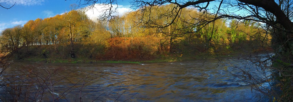
I was walking down the Irwell one day and spotted some outfalls in the riverbank. A bit of research showed they were related to Wet Earth Colliery, a site that started the extraction of coal from the Irwell Valley Fault in 1740. James Brindley was responsible for the tunnels that I'd seen, the eminent canal engineer was contacted in 1750 to advise on how to drain the workings which had flooded soon after their construction.
Brindley orchestrated the construction of several tunnels and structures related to this task and several parts can still be seen today.
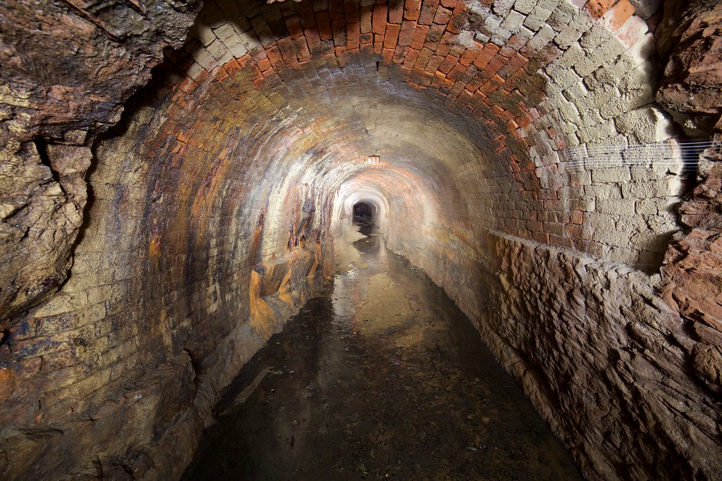
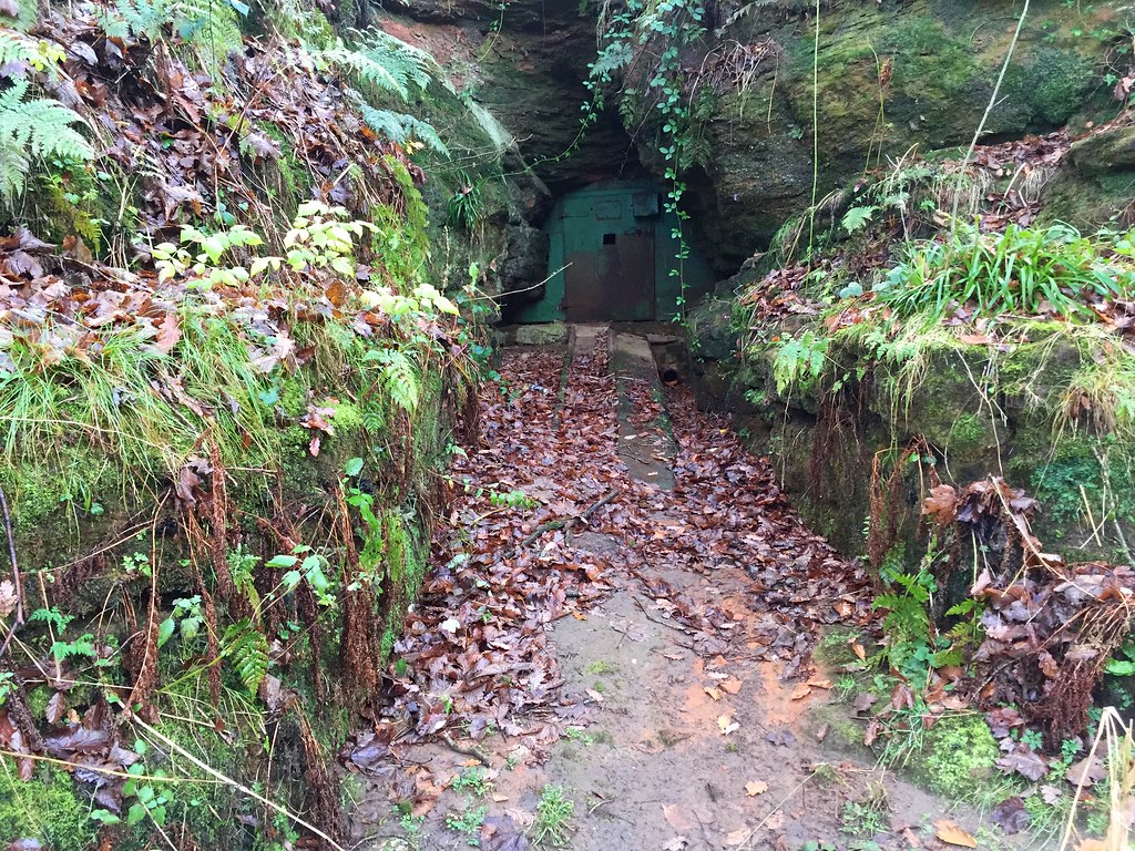
Water supply tunnel
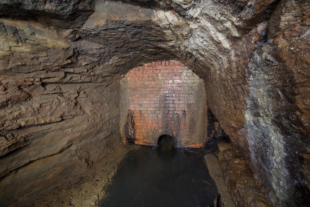
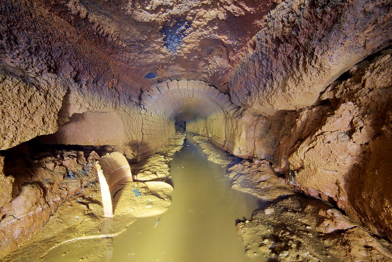
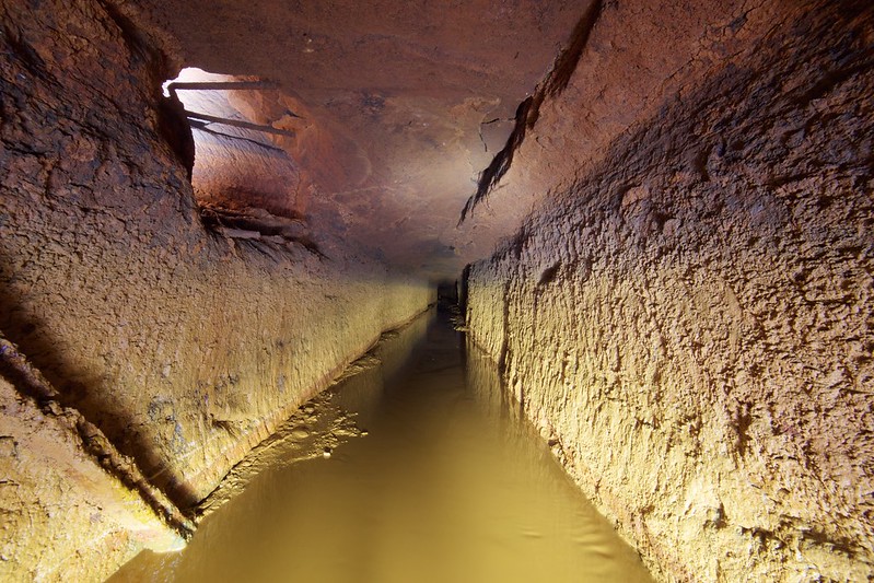
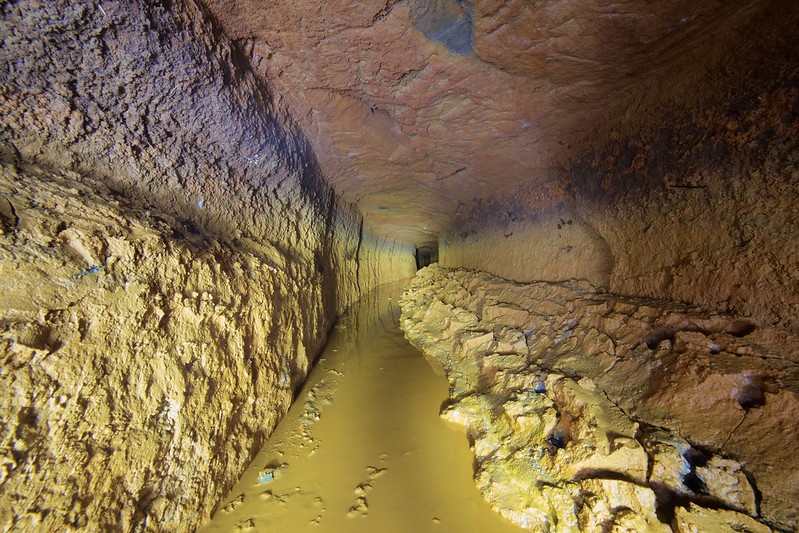
The power to drive the pump that dewatered the mine came from the River Irwell. A weir was constructed near Ringley to feed a 730m long, 7 ½ft tunnel on the opposite side of the river to the colliery. Building on that side meant it could be driven through the assumed soft sandstone on the north side of the Irwell Valley Fault. Once they started digging the ground actually turned to loser material and a great deal needed to be brick lined.
The inlet structure that can be seen today was rebuilt along with the weir in the 1920s. Inside is a brick arched chamber with 4 inlet ports that were covered by steel sluices. While the remains of the racks and pinions can be seen, the sluices remain out of sight below the current water level.
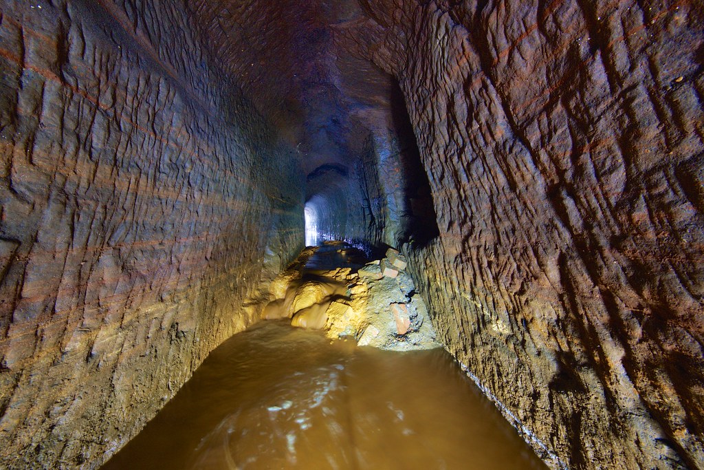
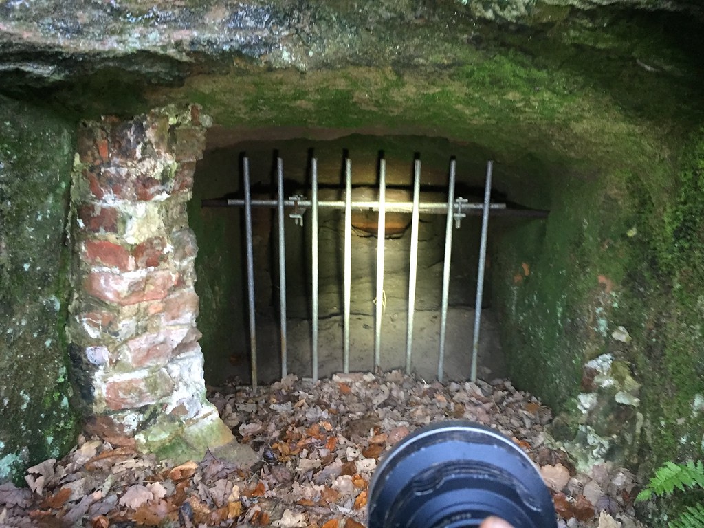
The tunnel ran along side the riverbank for 55m before a junction with a washout tunnel just downstream of the weir. There is no sign of the washout tunnel today, either it can only be seen at very low water or has been covered by rock. The tunnel was sealed in the 1960s when the site was bought for the sewerage works. One plug of concrete was poured in the washout junction and another before the tunnel entered the works boundary. Between these points the tunnel should be intact but the rest was collapsed leaving only a short section on the east side of the works.
A porous pipe was laid in the collapsed tunnel and forms the drainage for the works above.
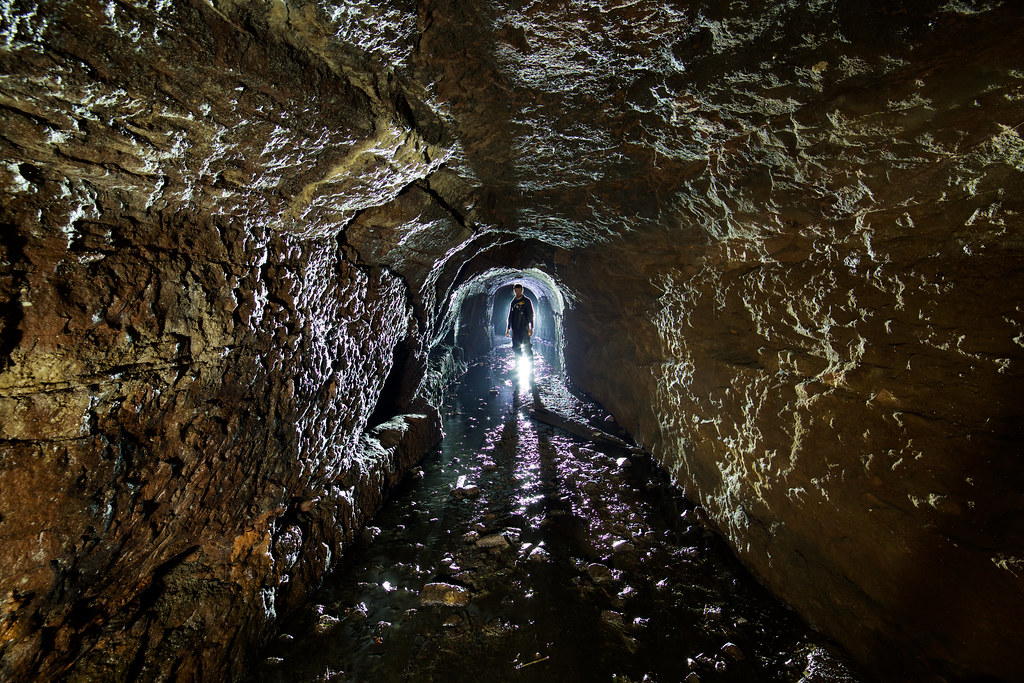
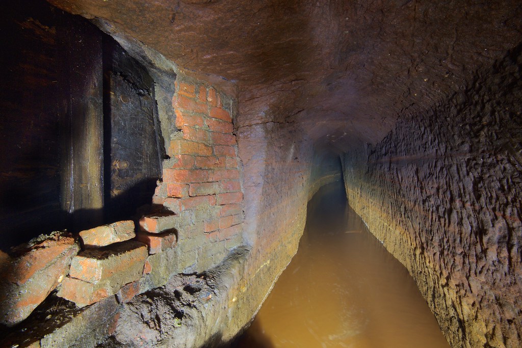
A downstream washout tunnel was also built and blocked by sluices, controlling the amount of water dropping down into a shaft (now walled off).
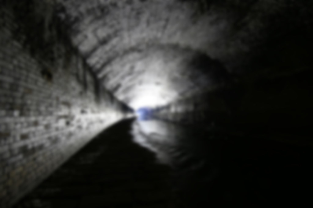
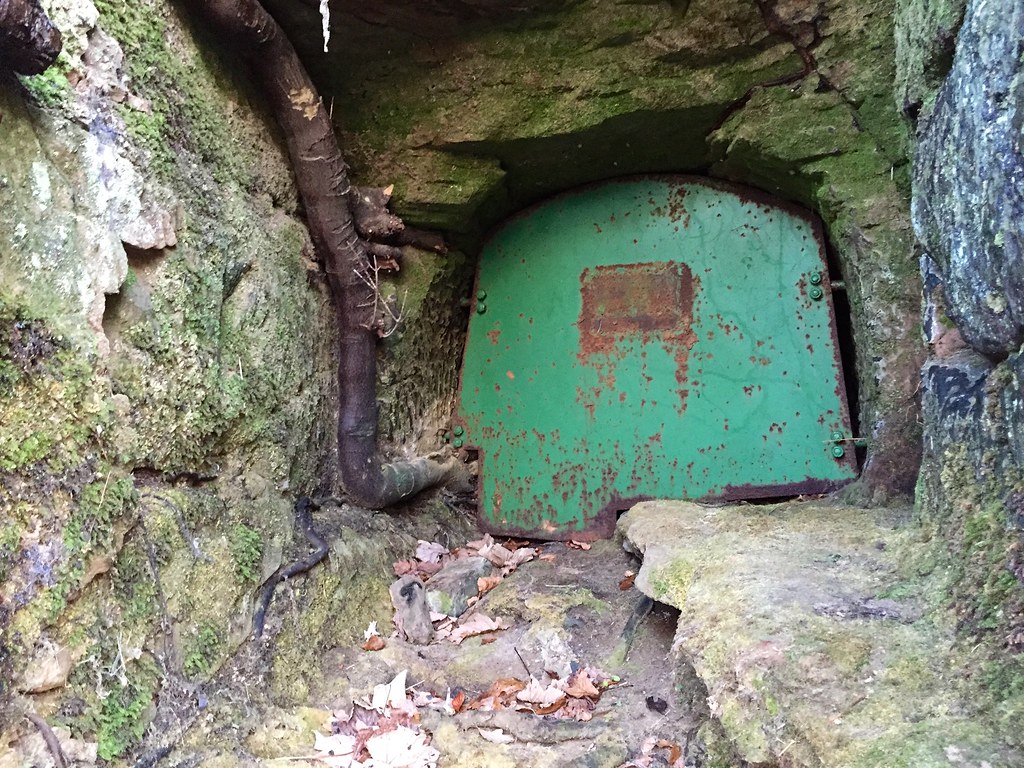
The siphon was one of Brindley's most innovative solutions; water flowed into the downcast shaft, along a tunnel under the riverbed, then into the upcast shaft in the opposite side of the river exiting at a higher level than it had entered at.
The upcast shaft can just be made out through a metal door, the water would have risen out into Fletcher's canal.
Surface features
The colliery closed in 1928 and became derelict. It started to become unearthed again in 1990 when Alan Davies, Museum Officer at Salford Mining Museum, formed the Wet Earth Colliery Exploration Group.
The wheelpit is a 30ft+ deep brick lined chamber that sits next to the Gal Pit shaft. It had filled in since the colliery closed, a combined effort from the exploration group and funding from Salford Council lead to it being excavated and a spiral staircase installed. The wooden waterwheel is long gone, a water turbine replaced it in later years but this now lies out of site underwater.
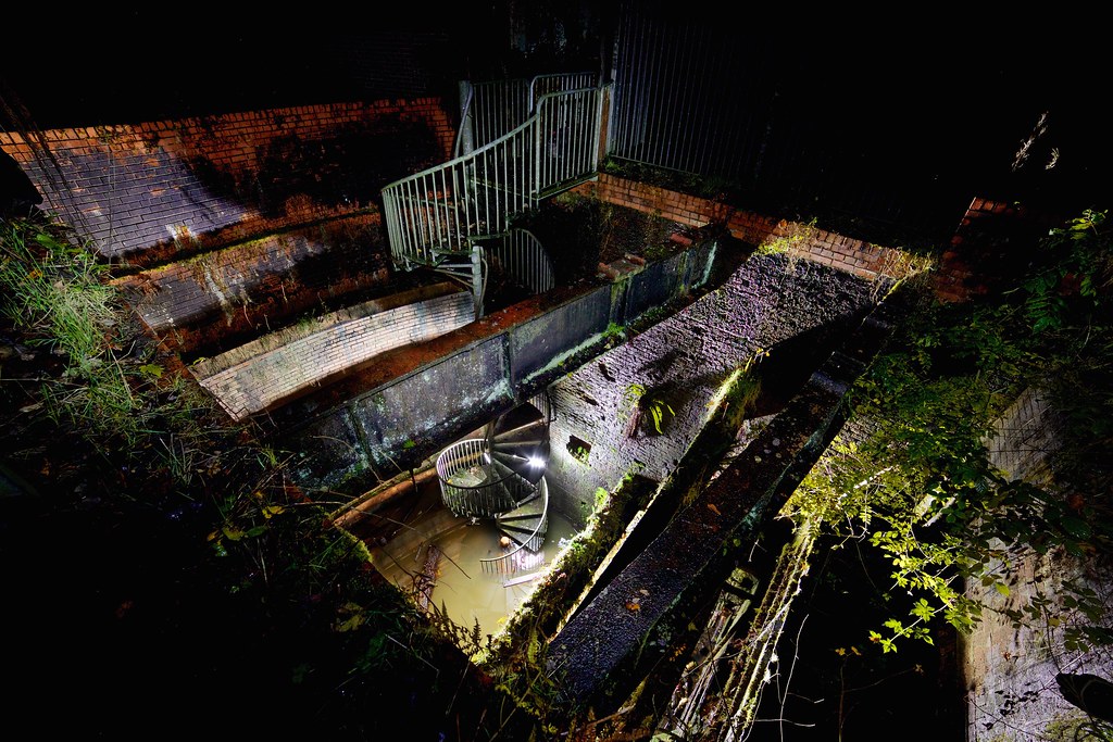
The water to power the wheelhouse came from Fletchers Canal and along the loading basin. A sluice and overflow slots along one side of the basin allowed control of the water level. After going through a portal known as the penstock arch was a short tunnel leading into the wheelpit. After turning the wheel the water left via a tailrace tunnel along with any pumped from the mine.
Drainage Tunnels
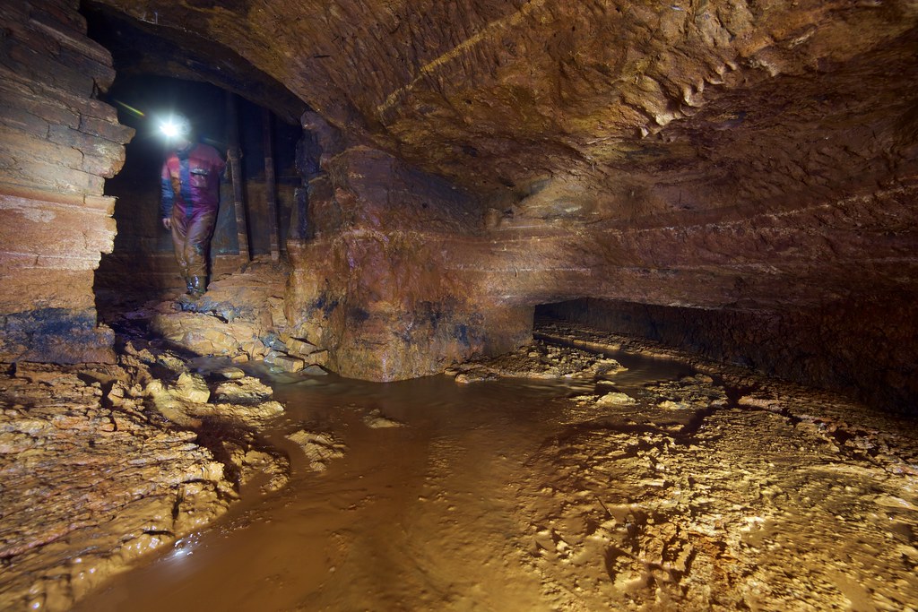
A system of tunnels that provided drainage to the Irwell connected the wheelpit, loading basin and Gal Pit shaft. They received the most attention by the exploration group who had found silted up tunnels on the riverbank and spent months digging them out and exploring. An excellent pdf, "Diary of Exploration Volume 1" by Mark David Wright, details the exploration and is well worth a read. Link
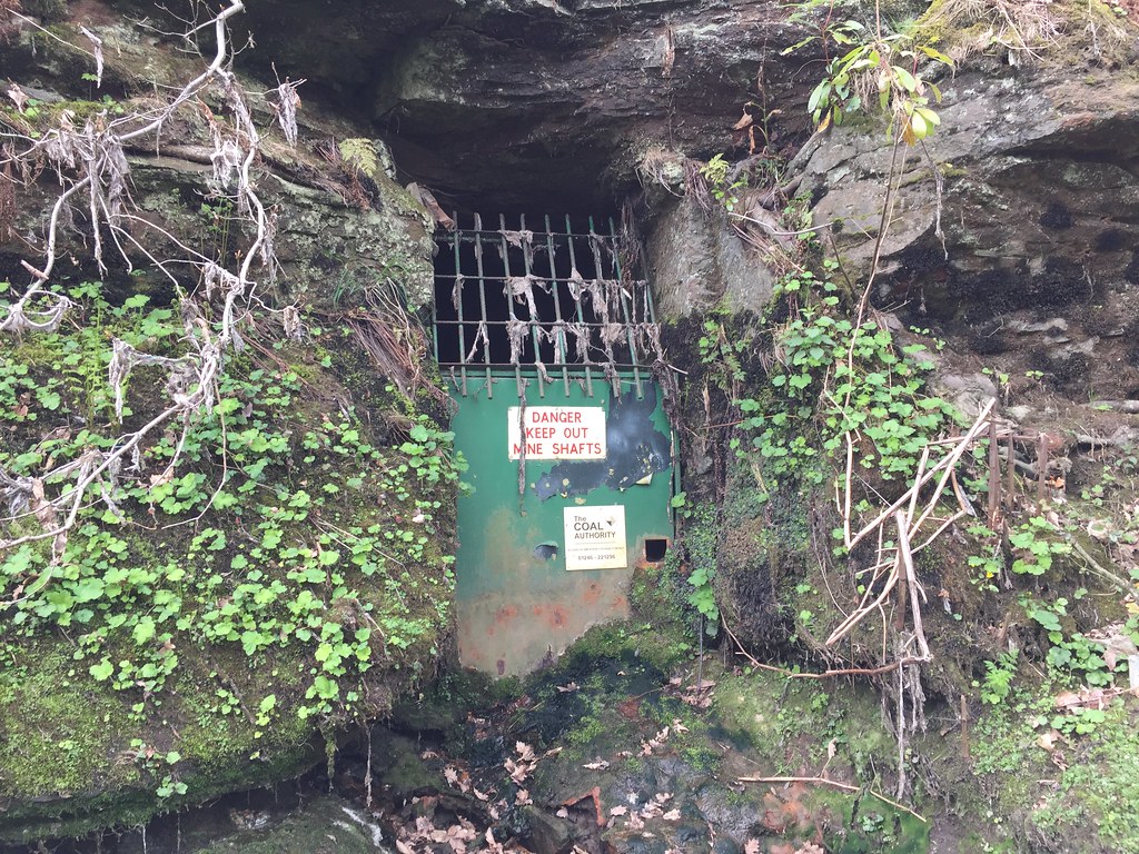
The Manchester Evening News published a fear mongering article about safety in February 1997 and the Coal Authority sealed the tunnels up. I was curious if the tunnels were still inaccessible 17 years later so set down the riverbank to find them and returned a few years later with Userscott.
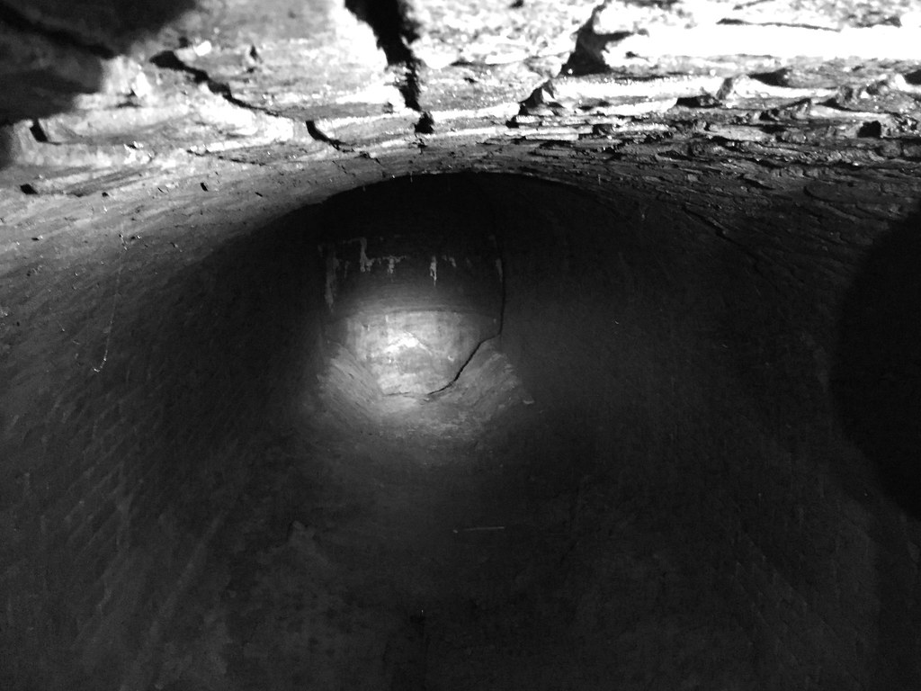
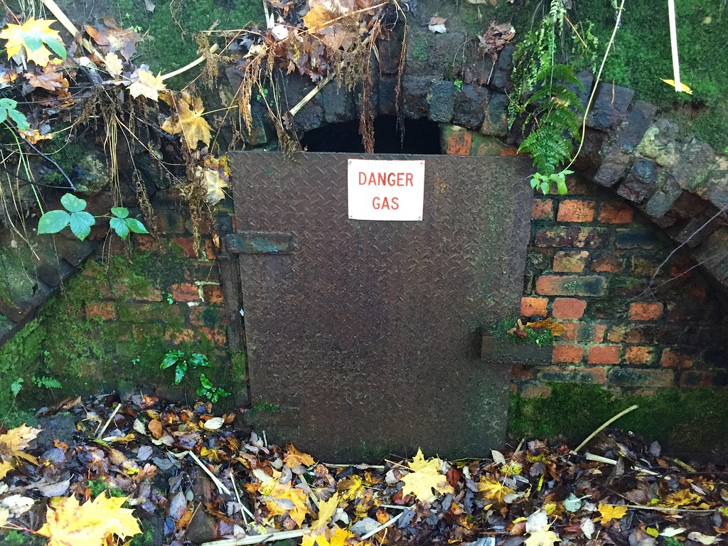
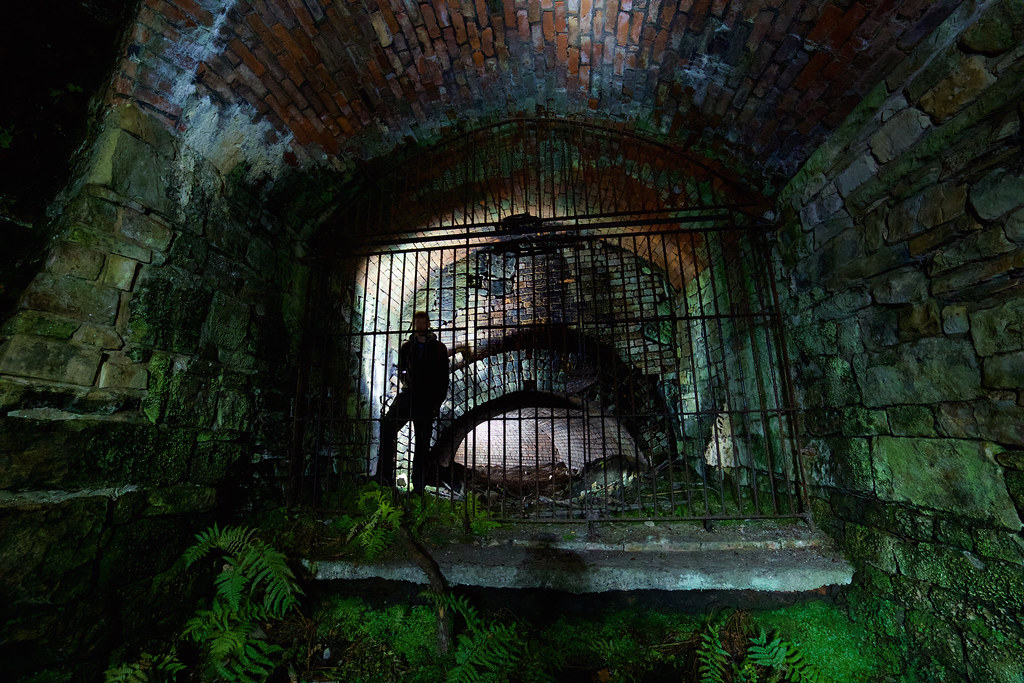
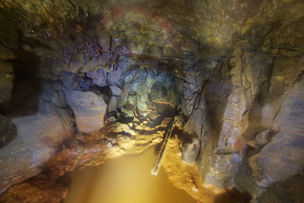
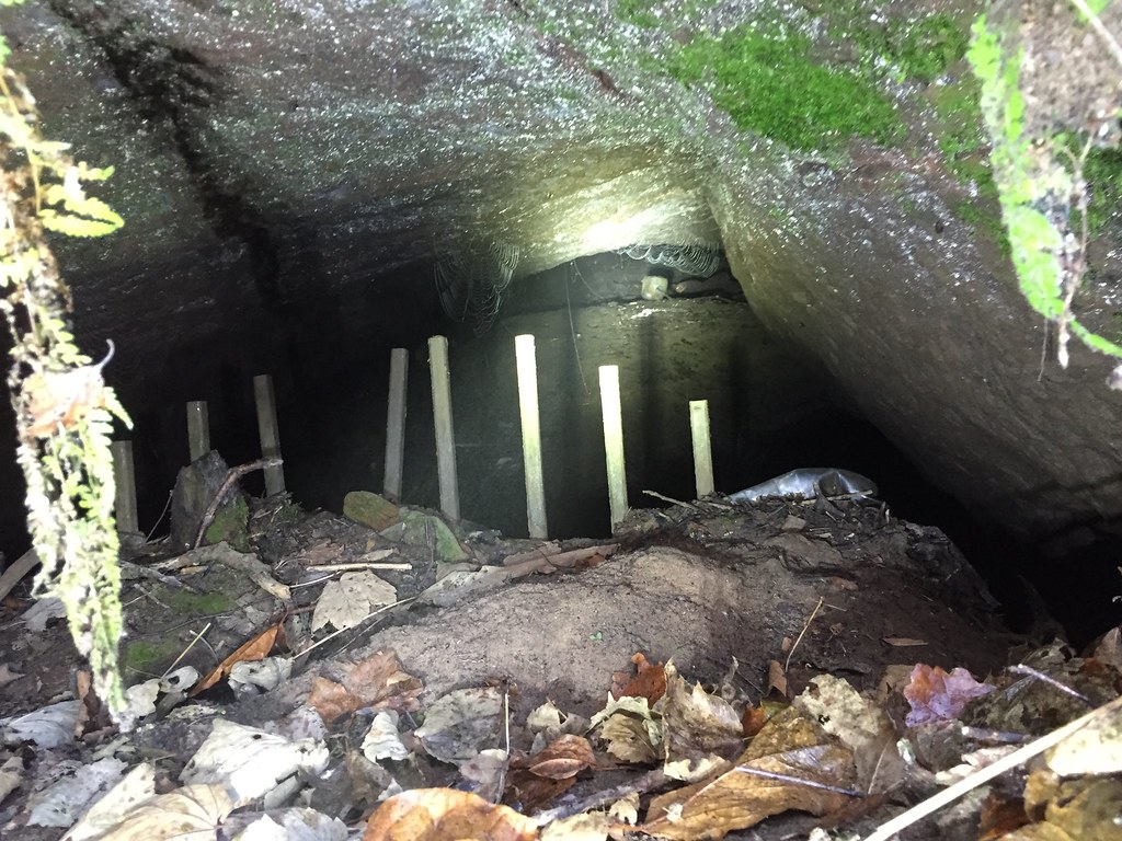
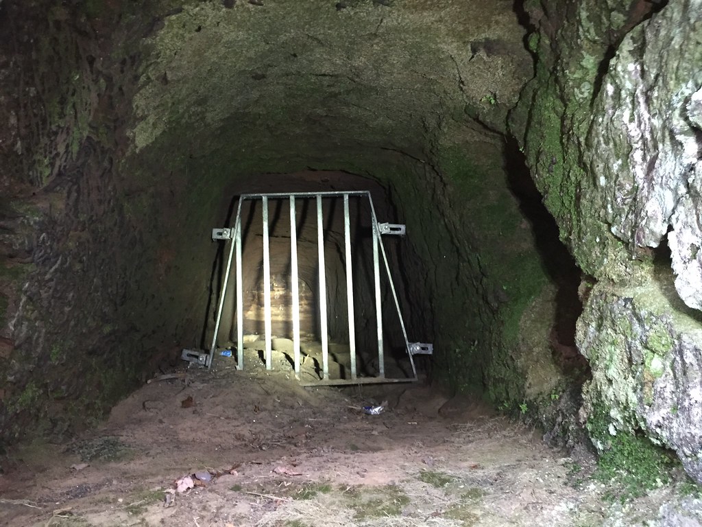
Service Tunnel - E
The main tunnel has a locked metal door, a small hole allows the inside to be seen, the tools used by the exploration group discarded within.
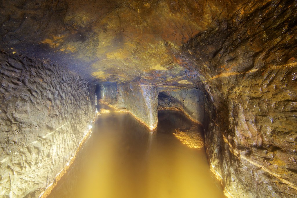
Inside the tunnel is in pretty good shape, a couple of drainage pipes allow the free flow of water which have helped stop it becoming too silted up.


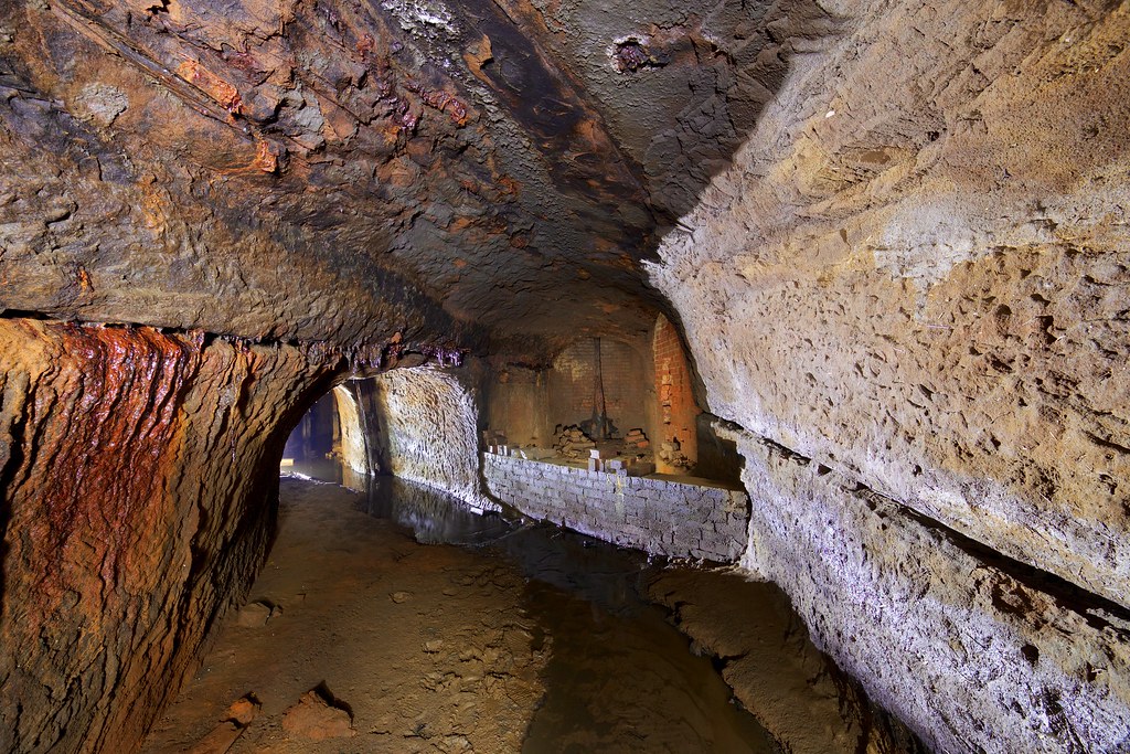
The tunnel starts off around 6ft tall and coloured bands can be seen running through the walls.

A couple of small side tunnels ran off, the largest was explored for a way. The exploration group had used it to store pipes in, further on it split. The smaller branch a low crawl that was left unexplored and the largest went to what initially looked like a dead end but closer inspection showed what looked like a penstock at the end.

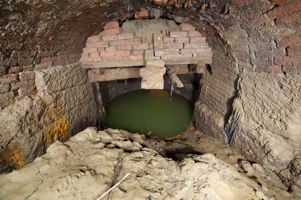
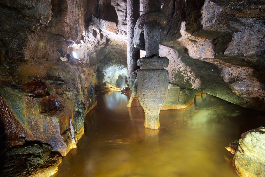
The first major function is with the square shaft, like all shafts in the system it was capped long ago and now a rungless ladder leads upwards.


On another visit the water level had dropped considerably allowing the lower 'G' tailrace tunnel to be seen on the other side of the chamber. This will be looked at in further detail later on.

After a stoopy trudge through a low brick lined section and the rocky fault was the pump shaft. This held a couple of pipes once connected to a pump and was also a 4 way junction. The photo looks downstream and the right hand branch lead to the G tunnel, upstream of where it was last seen at the Square Shaft junction. The roof can be seen dipping down where it mets the water level, held up behind a large bung of gravel in the G Tunnel.
After the water level rose considerably and you could more or less just swim.


After going through what looked like a door the tunnel hit a junction afterwhich it shrank considerably, a muddy orche sludge sat just below the waterline and crawling up it threated to set the whole lot moving. Any further progress this way would be unpractical unless the water level could be reduced. No photos of that as was esstentially a flat out crawl at that point.
The side tunnel which branched off lead to the side-weir overflow beside the loading dock.

The brickwork at the base of the shaft had deteriorated pretty badly. At the top of the shaft the bricked up hole could be seen that once housed the sluice that allowed water levels to the Penstock Arch and Wheelpit to be controlled.

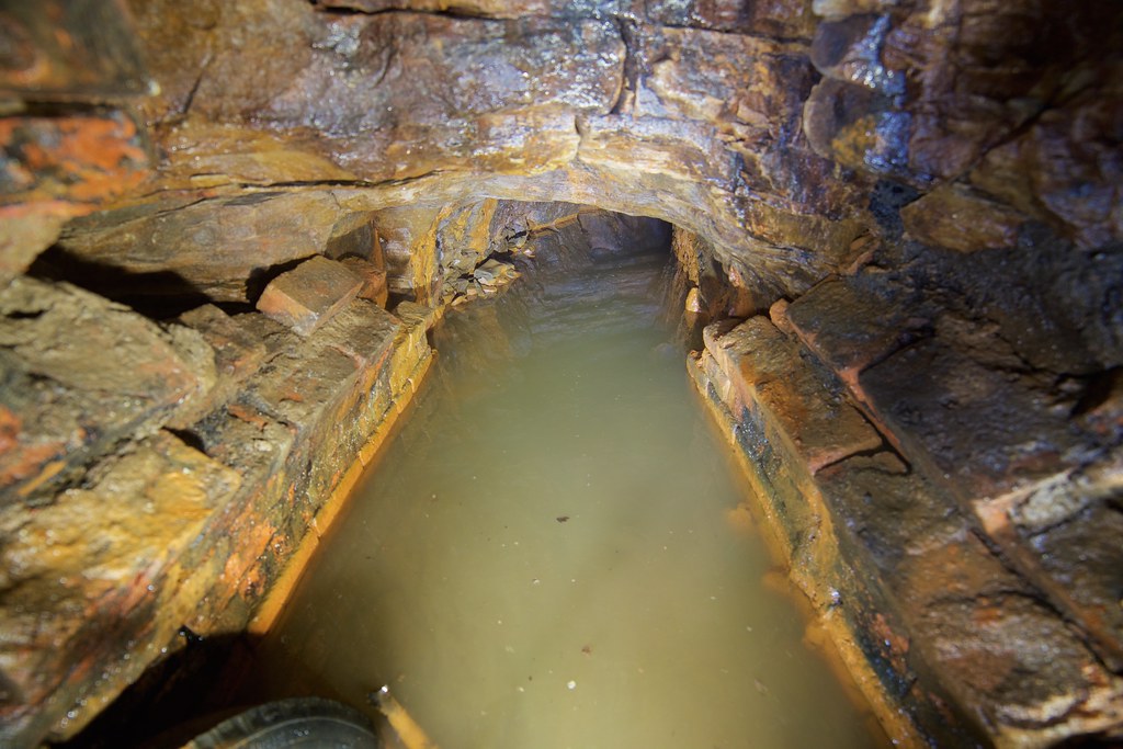
Tailrace Tunnel - G
The Tailrace's job was to take the water used by the waterwheel in the Wheelpit, and the water pumped out the mine via Gal Pit Shaft and convey it to the Irwell.
Traveling down this tunnel is slow in the thick mud underfoot and everything gets covered in thick orange Ochre and mud.


Various plastic chairs were to be found either underfoot, poking through the sluge or jammed in an alcove.

Another capped shaft


A low dip and the tunnel emerged into the larger space of the Square Shaft junction.

A water hose used by the exploration group snaked from the lower Service Tunnel upto this point and was still under pressure as water was siphoning through it, a small jet coming through a pinprick in the pipe. Impressive for something over 20 years old.
The airflow can be an issue in here, we had to leave sharply once when the O2 meter started chirping.
Around the corner a large bung of gravel/orchre/mud blocks the passage to the ceiling, the start of which can be made under the arch shown below.

Upstream of the bung is the connection to the Wheelpit and an upper series of tunnels which are presently inaccessible. The exploration group pushed into these for some way and uncovered connections to shafts and what could be a much older tunnel beyond. Perhaps one day these too could be explored again.
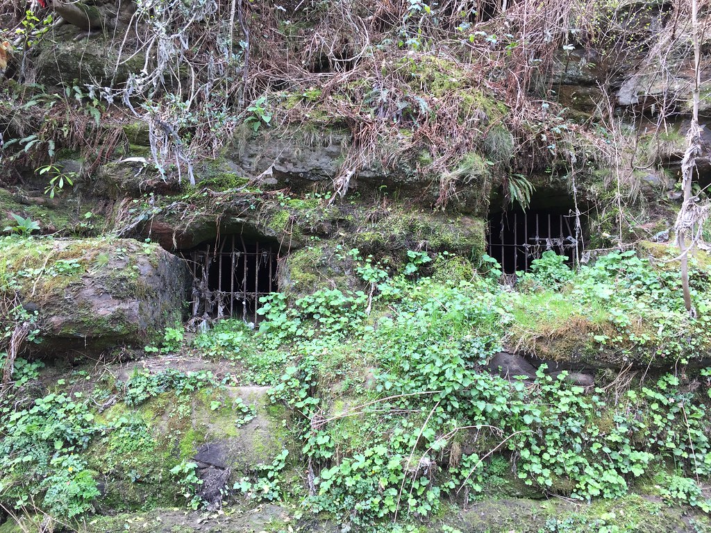
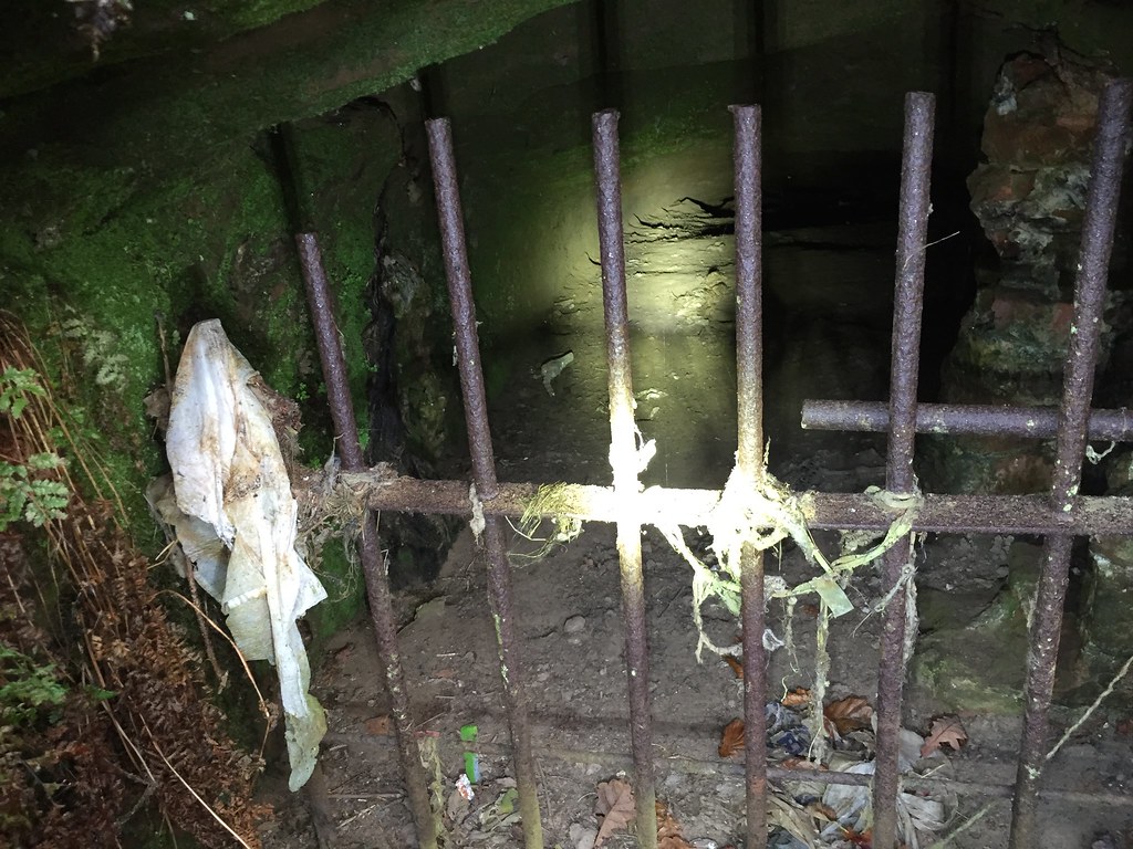
Other tunnels
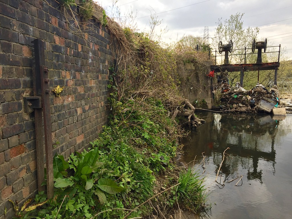
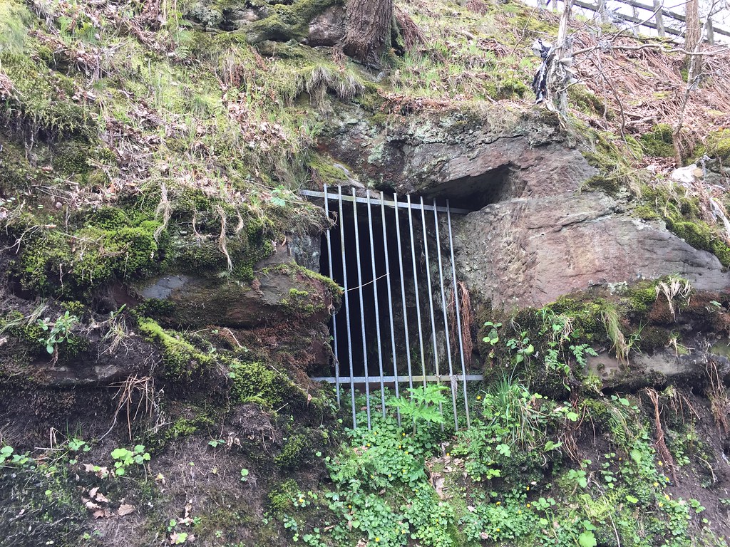
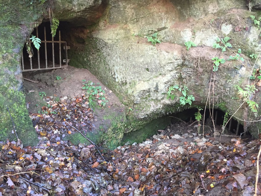
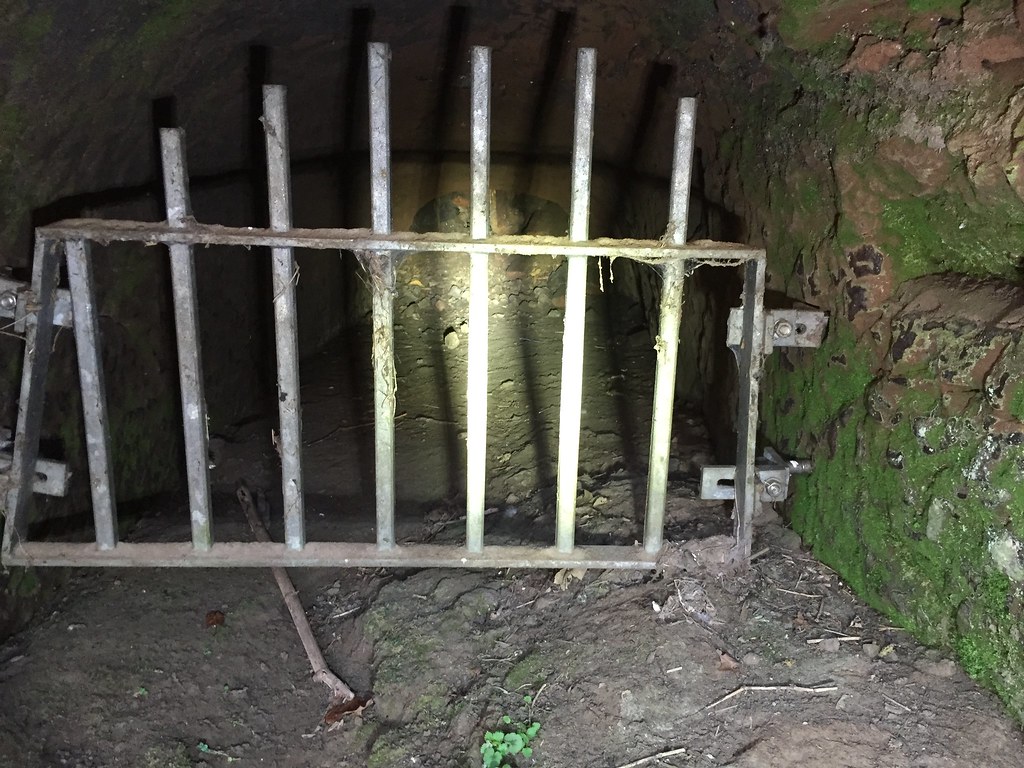
Many other adits line the banks of the river around the area. All of which are grilled and most backed up with sediment.
It's a shame this site has been left to rot after the initial investment to start clearing it, several areas such as a turbine house on the riverbank have gone past the point of saving. What could have been an asset to tourism is instead left to clog up and degrade.